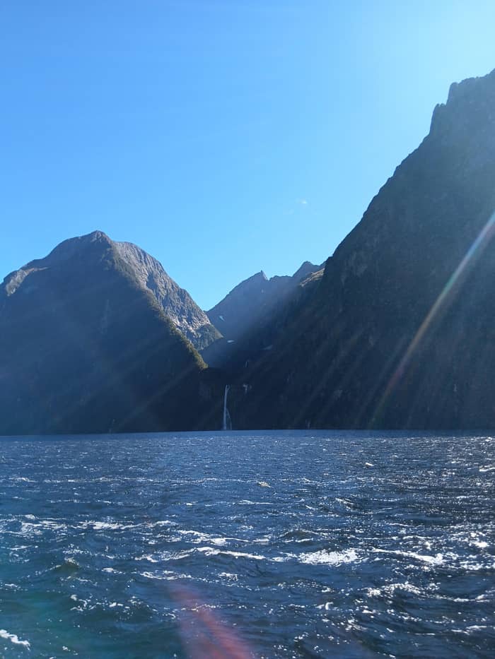
Waterfalls
After heavy rain
The walls turn white
- FallsThousands appear
- Best spotHarrison Cove
- WearFull waterproofs
Guides
Language
Currency
Check open spotsfrom $99 · cancelling is freeLook up your stop
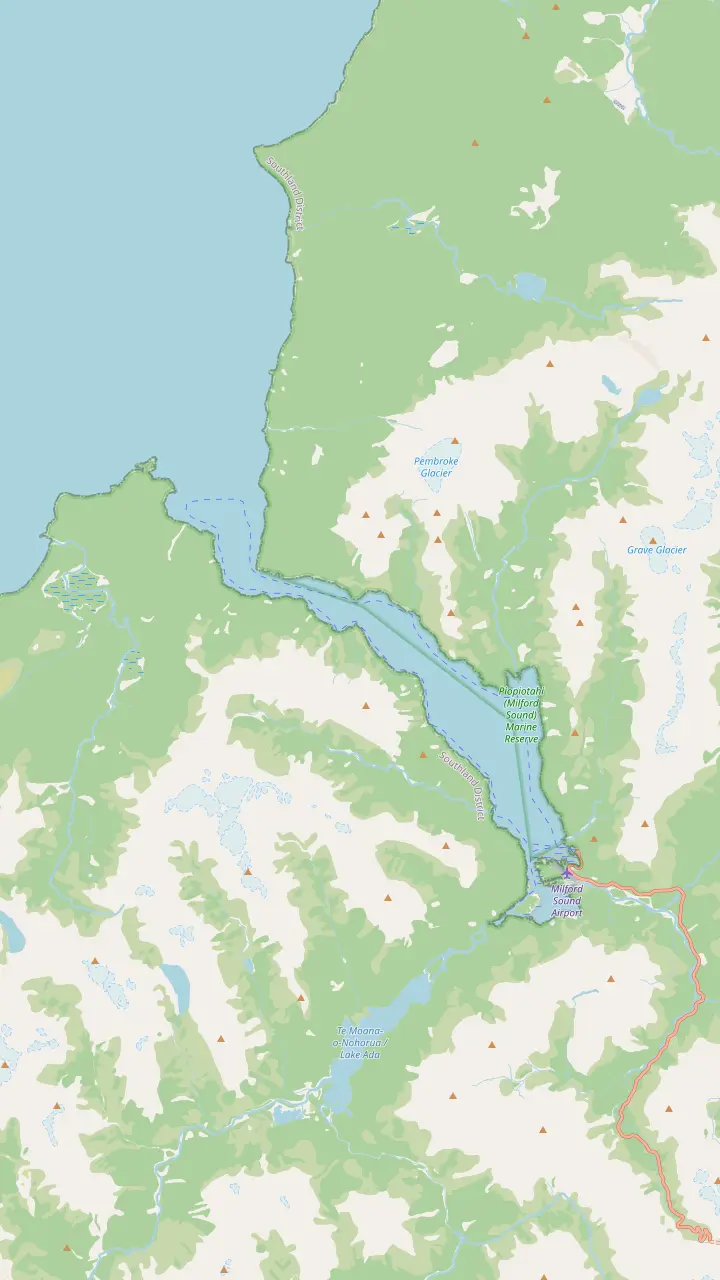
Map of 17 stops
First pick a route, then tap any pin or stop for details and Google Maps.
A year-round fall beside the wharf; Southern Discoveries gives it a 162 m drop and says it powers the village.
Google MapsThe peak whose walls rise 1,692 m straight from the water, best seen from the boat on the way out.
Google MapsLion Mountain, named in the small-boat listing; Stirling Falls pours from the valley beside it.
Google MapsA bay where RealNZ points out Mount Pembroke's glacier above the forest.
Google MapsThe other year-round fall: 146 m by RealNZ's figure, and boats go in under its spray.
Google MapsThe Elephant, the mountain on the far side of Stirling Falls' hanging valley.
Google MapsA headland on the way out towards the Tasman Sea, with Seal Rock nearby.
Google MapsA hanging valley left high by the ice, a classic example of the shape.
Google MapsA headland near the entrance, where the fiord begins to open to the sea.
Google MapsThe bay near the mouth where takiwai, a translucent greenstone, was gathered.
Google MapsThe light the small boat passes before it turns for home.
Google MapsSnow-capped Mount Pembroke, with its glacier, rising behind Harrison Cove.
Google Maps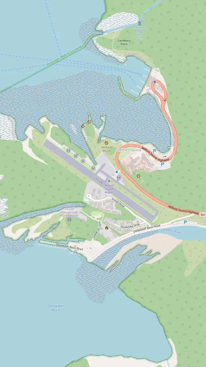
Every day cruise checks in here, on State Highway 94; on one small-boat fleet, check-in is 30 minutes before sailing.
Google MapsA year-round fall beside the wharf; Southern Discoveries gives it a 162 m drop and says it powers the village.
Google MapsThe inner harbour at the head of the fiord, with the terminal and its wharf.
Google MapsThe basin by Deepwater Basin Road, where the free car park is; Mitre Peak Cruises calls the walk to the terminal 40 minutes, RealNZ about 20.
Google MapsThe airstrip that the foreshore path passes on its way from the lodge to the terminal.
Google MapsWhere the Cleddau River meets the fiord, beside the terminal and the airport.
Google MapsMap data: © OpenStreetMap contributors
What to see in Milford Sound on a cruise, in the order the boat meets it: the falls by the wharf, the great peaks, the seals, the open sea at the mouth and the glacier above Harrison Cove.
Editorial team, milfordsoundcruise.click · Updated November 8, 2026 · ~8 min read
Essentials
Every day cruise on Milford Sound follows the same simple line. The boat leaves the wharf at Freshwater Basin, runs out along one wall of the fiord to where it meets the Tasman Sea, turns, and comes home along the other wall. Visit Fiordland puts the length of that line at 16 km, measured from below Mitre Peak to the sea.7 The small-boat cruise this site books sails the whole of it and goes out past the lighthouse on St Anne's Point before turning.
The exact stops change from boat to boat and from day to day. Southern Discoveries says its boats all travel the fiord end to end when conditions allow, and that while the stopping places differ, each trip takes in Stirling Falls and Harrison Cove.8,9 That is a fair summary of the whole fleet: the landmarks are fixed, and the skipper picks the order, the pauses and how close to go on the day, reading the wind and the water.
On this site's cruise the skipper talks you through it, and the listing names the landmarks you will hear about: Lady Bowen Falls, Stirling Falls, Lion Mountain, Seal Rock and Copper Point. This Milford Sound cruise map, at the top of the page, follows those names and adds a few more that every boat passes. Read it once before you board and you will know which way to look when the engine slows.
Landmark by landmark
| Landmark | Side of the fiord | What to look for | Source |
|---|---|---|---|
| Lady Bowen Falls | Wharf end | A permanent fall that powers the village | Southern Discoveries3 |
| Mitre Peak | Southern wall | A face of 1,692 m straight from the water | DOC4 |
| Sinbad Gully | Southern wall | A textbook hanging valley | Mitre Peak Cruises15 |
| Stirling Falls | Northern wall | The fall the boats nose into | RealNZ5 |
| Seal Rock | Towards the mouth | Fur seals hauled out | RealNZ18 |
| Anita Bay | Near the mouth | The greenstone bay | DOC19 |
| St Anne's Point | The entrance | The lighthouse and the open sea | Listing |
| Harrison Cove | Northern wall | Mount Pembroke and its glacier | RealNZ13 |
Sides follow the map above; the boat may take them in either order. Heights and descriptions are as each source gives them.9
Wondering what to expect on a Milford Sound cruise? The first great sight is visible before the ropes are untied. Lady Bowen Falls pours down the cliff just along the shore from the terminal, and boats often swing in towards it on the way out or on the way back. It is one of the fiord's permanent falls, so it is running even on the driest day of summer.11 Southern Discoveries gives its drop as 162 m from a high valley floor, and Mitre Peak Cruises gives 160 m.14,15
The fall is a working one, too. RealNZ calls it the water supply of the settlement, and Southern Discoveries says it also drives the hydro-electric power for the small village and its hotel.2,3 So the coffee in the terminal and the lights in the lodge both owe something to the white ribbon you are photographing. It is a neat introduction to a place where water decides almost everything.
The name is a piece of colonial history. Southern Discoveries says the fall honours Lady Diamantina Bowen, the wife of the fifth Governor of New Zealand.16 On a wet day the spray from its base drifts across the water, so if you want a dry photograph of it, take it early, from the stern, before the boat has turned towards it.
Once the boat is clear of the basin, the view opens up to the peak that made the fiord famous. DOC describes Mitre Peak as rising 1,692 m straight out of the water and ranks it among the world's best-known, most photographed mountains.4 From the water it looks less like a postcard and more like a wall, because you are looking up at it from sea level rather than across at it from the shore.
Mitre Peak Cruises points out that what looks like a single summit is in fact 5 closely grouped peaks, and that the name comes from its likeness to a bishop's mitre.20 Visit Fiordland gives it the Māori name Rahotu as well.7 Mitre Peak gets a page of its own here, covering the light hour by hour and where to stand for the classic reflection.
Just beyond it, look for a high valley that seems to stop in mid-air. Mitre Peak Cruises names Sinbad Gully as a classic example of a hanging valley, a side valley left high when the main glacier cut the fiord far deeper than its tributaries.15,21 Once you can recognise that shape you will see it again and again along both walls, often with a waterfall spilling from its lip.
Plan your deck time
Match what you most want to see to a moment on the route.
If I want the classic Mitre Peak photo
Outer deck, early in the cruise
The peak rises straight from the water on the way out.4
If I want to feel a waterfall
Bow, at Stirling Falls
Boats go right in beneath it.12
If I want to see seals
Rail, near Copper Point
Seal Rock is out towards the mouth.6
If I want the open sea
Stern, at the entrance
The small boat turns past St Anne's Point.
If I want to stay dry and warm
The lounge, with its big windows
Tea and coffee are free inside.
Three moods of the fiord
Waterfalls
The walls turn white
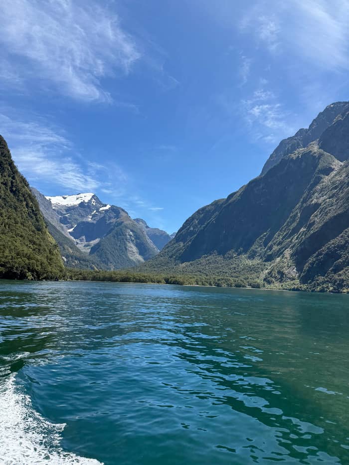
Views
Peaks and reflections
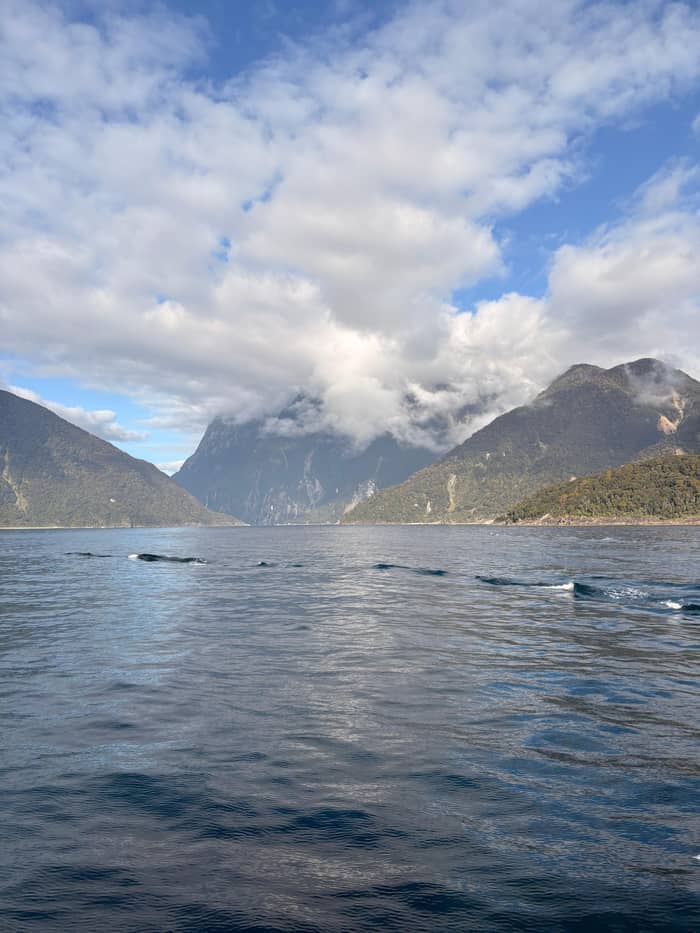
Atmosphere
Moody and close
Across the fiord on the northern side stand the mountains with the animal names. Lion Mountain is one of the landmarks the small-boat listing names, and RealNZ places Stirling Falls in the hanging valley between the Elephant and Lion mountains.5 On the map they sit just across the water from Mitre Peak, so you are looking from one great face of rock to the other as you pass.
Stirling Falls is the moment most passengers remember. RealNZ gives it a height of 146 m and Southern Discoveries 155 m; both call it the fiord's other permanent fall after Lady Bowen.5,17 RealNZ says it was named after Captain Stirling, who brought the HMS Cleo into the fiord in the 1870s.27 The falls page on this site goes through how close each kind of boat gets and how wet you will be.
Southern Discoveries says local cruises take you right in beneath the fall, and the listing for this site's cruise recommends a waterproof jacket because the boat goes very close to the waterfalls.12 Mitre Peak Cruises also promises the spray of Fairy Falls on its own 2-hour cruise, another fall on the route that runs hard after rain.28,29 Put your phone in a pocket before the bow goes in.
Price the route
Set your group size and compare cruises that run the length of the fiord.
Weigh up 3 options
Set your group size and compare cruises that run the length of the fiord.
≈
View≈
View≈
ViewFigures are GetYourGuide from-prices, translated at the ECB reference rate. The booking step shows what you pay exactly.
What to expect
Boarding
Mitre Peak Cruises asks for 30 minutes before departure.10
Leaving
The permanent fall beside the terminal comes first.11
Outbound
The great southern face fills the view.4
Outbound
The boat edges in under the spray.12
The mouth
The boat turns past St Anne's Point lighthouse.
Homeward
Mount Pembroke's glacier above the forest.13
Further out, the fiord narrows towards its entrance and the cliffs drop closer to the boat. RealNZ describes slipping past Copper Point towards the Tasman Sea, weather permitting, with an eye on Seal Rock for fur seals.6 Both names appear in this site's cruise listing too, so expect the skipper to slow here.
Seal Rock is a resting place for New Zealand fur seals. RealNZ notes that they were hunted almost to extinction in the 1800s for their fur and have since recovered so well that they are seen all year.18 Mitre Peak Cruises goes further and says on its own cruise you will see fur seals lounging on the rocks; dolphins and Fiordland crested penguins need more luck.30 Southern Discoveries is careful to say no sighting can be guaranteed.31
These animals live here, and DOC lists bottlenose dolphins, fur seals, Fiordland crested penguins and little blue penguins among the fiord's residents.32 Its advice for everyone on the water is to let the animals decide how close they come and never to stress them by approaching.26 A good skipper keeps that distance for you; your part is to keep your voice down and enjoy it. Seal Rock is one stop among many, so enjoy it and then look up again.
Video
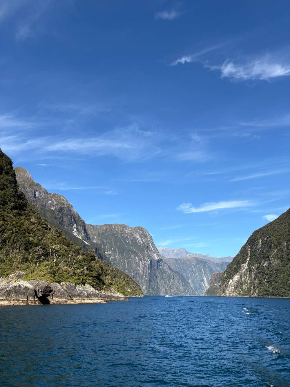
Helen and Tim Travel on YouTube · The video only starts loading on your tap.
At Harrison Cove, watch Mt Pembroke and its glacier above the rainforest canopy, and spot the end of the Milford Track across the water.
Before you sail
Near the mouth, on the southern shore, is a bay with a long human history. DOC records that Māori came to Anita Bay and nearby spots by the entrance for takiwai, a translucent greenstone, and RealNZ calls the bay treasured for its pounamu.19,33 Look for a small break in the cliffs and a shingle beach; it is a quiet place now, but for centuries it was a destination worth the journey.
Then the walls fall away and the open sea appears. RealNZ calls this a once-hidden entrance that explorers such as Captain Cook kept clear of because the coast was so treacherous.34 From inside the fiord you will understand why: the opening is narrow and easy to miss from offshore. The small-boat cruise goes out past the lighthouse on St Anne's Point before it turns for home.
Mitre Peak Cruises takes its passengers right out into the Tasman Sea, so they can look back and approach the fiord the way the first sealers did.35 It is the part of the trip where the boat may start to move with the swell, and the view behind you, a slot of cliffs and cloud, is the one you will want to remember. If the sea is rough, the turn is made earlier, which is why the route is always described as weather permitting.6
The return leg usually runs along the opposite wall, and its highlight is a wide bay on the northern side. RealNZ says that from Harrison Cove you can watch Mount Pembroke and its glacier above the rainforest and pick out the end of the Milford Track across the water.13 Mitre Peak Cruises also points to snow-capped Mount Pembroke on its commentary.15
Harrison Cove is also where the forest comes closest to being the subject. The trees here grow on almost bare rock, and after rain every gully runs white. Mitre Peak Cruises says that in rain the cliff faces come alive with thousands of waterfalls, so the homeward run on a wet day can be busier than the outward one.36 In clear weather, this is where to look up and find the ice.
All of this sits inside a marine reserve, Piopiotahi (Milford Sound) Marine Reserve, one of 10 in Fiordland.37 Nothing is taken from it, so the life along the walls is left as it is. By the end of a Milford Sound sightseeing cruise, as you round the last point and see the terminal again, you will have seen the fiord from both sides and from the sea, which is the whole point of the route.
FAQ
DOC gives the fiord a length of 16 km to the open sea, and the small-boat cruise runs all of it before turning.1
Southern Discoveries sends every boat the whole way out when the weather permits.8
The boat runs out along one wall and back along the other, so each side gets its turn; the decks let you move.
Southern Discoveries says cruises go right in under the fall; bring a waterproof layer.12
The pins follow the landmarks the small-boat listing names, with Harrison Cove and Anita Bay added.9
Sources
Continue reading
Wondering which sailing to pick or what if it rains? Ask a real person.